Two-Dimensional Flood Routing Model
The FLO-2D Pro Model is the most comprehensive and affordable 2-D flood routing tool. CONTACT USTAILINGS DAM
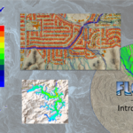
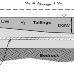
Flood modeling for global tailings dam standards
HYDROLOGY
Rainfall and infiltration applied to the grid
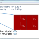
OVERLAND COMPONENTS
Levees, dams, watershed tools
URBAN FEATURES
Urban flood routing with storm drain, LID, and complete drainage systems
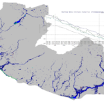
CHANNEL ROUTING
Riverine studies, canyon flooding, urban drainage channels
Subscription to FLO-2D includes
Technical Support
Free Training Webinars
Model Updates
Discount Short Courses
Newsletter
Training Certificates
FLO-2D Pro = Comprehensive, Affordable and Easy Flood Modeling
The FLO-2D Model was conceptualized in 1987 to predict mudflow hydraulics. It has been adapted to conduct any sort of overland and channel modeling type. This includes urban flood mapping, alluvial fans, coastal flooding, dam breach, and solar and wind power sites. FLO-2D uses QGIS and the FLO-2D Plugin to build models. This is a comprehensive GIS tool that is free and open source.

FLO-2D Training Packages
Self Help Kit

Getting Started
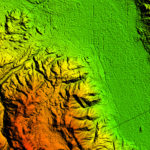
Elevation Data
Channels
Mapping
Modeling Theory
Project Review
Tailings Dam
Get started for €2400 + VAT/year and renew for €1450 + VAT/year service agreement for unlimited elements and unlimited computer stations per site.